Craigieburn Trapping Alliance
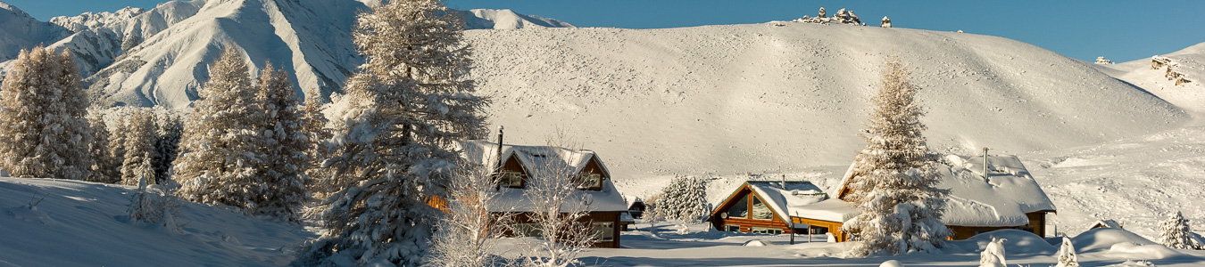
The Craigieburn Trapping Alliance (CTA) was established in 2019 and is based in the Canterbury High Country centered on the Castle Hill Basin. The ecology of the Castle Hill Basin is both unique and diverse containing mixed beech forest and subalpine tussock grasslands, limestone outcrops, alpine scree and peaks of the Craigieburn Range, grey shrublands of matagouri, coprosma and olearia species, braided rivers and high-country lakes as well as developed pasture. The altitude ranges from 600m to over 2000m.
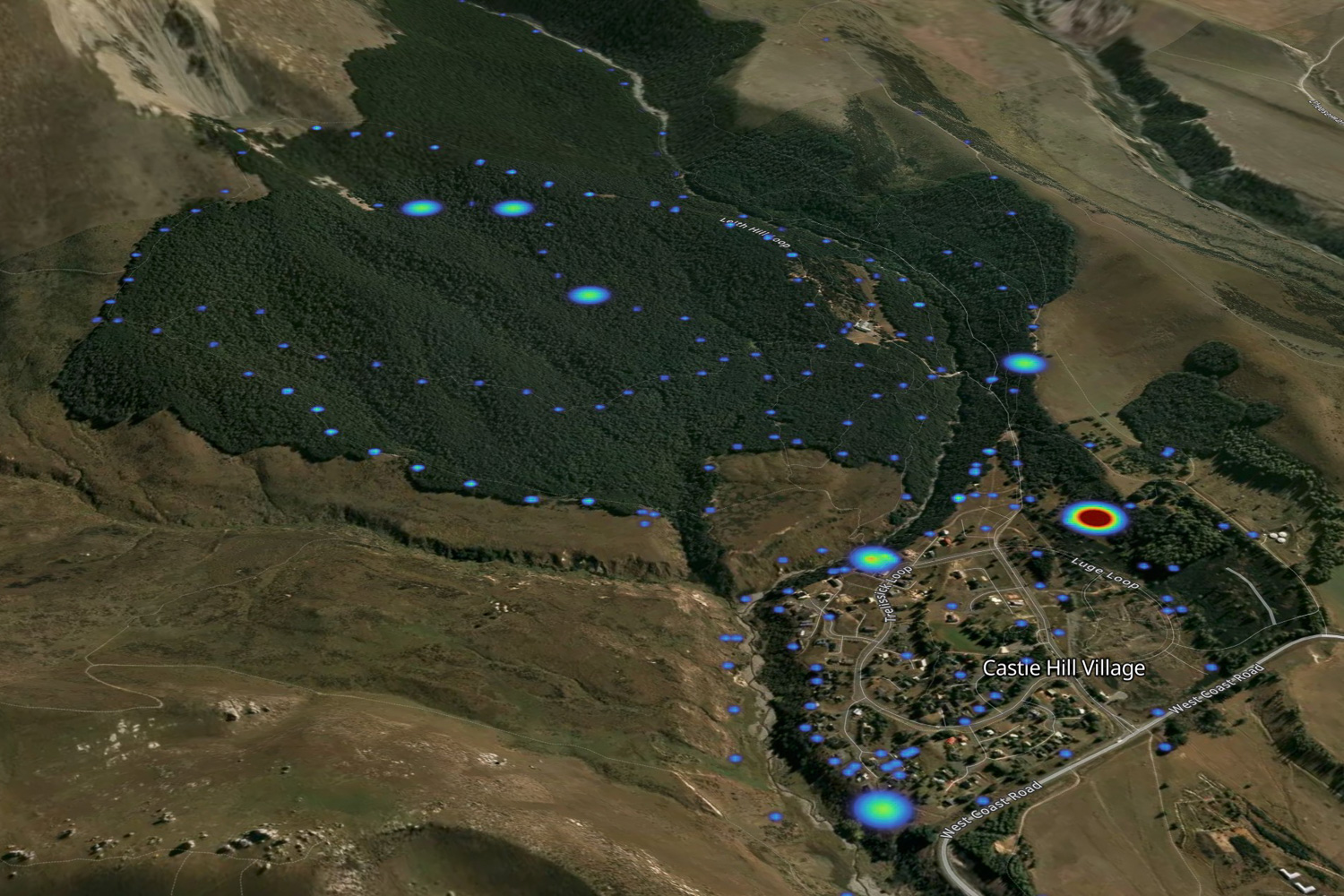
The CTA trapping area covers a total of 62,000 hectares of public and privately owned land, from the Cass River in the north, to Lake Lyndon in the south. The majority of trap lines are in the Craigieburn Forest Park but also include Korowai/Torlesse Tussocklands, Castle Hill Village and other residents/ holiday homes in the area, high country station land, local ski clubs, and school outdoor education facilities. This area is of major cultural importance to Ngai Tahu.
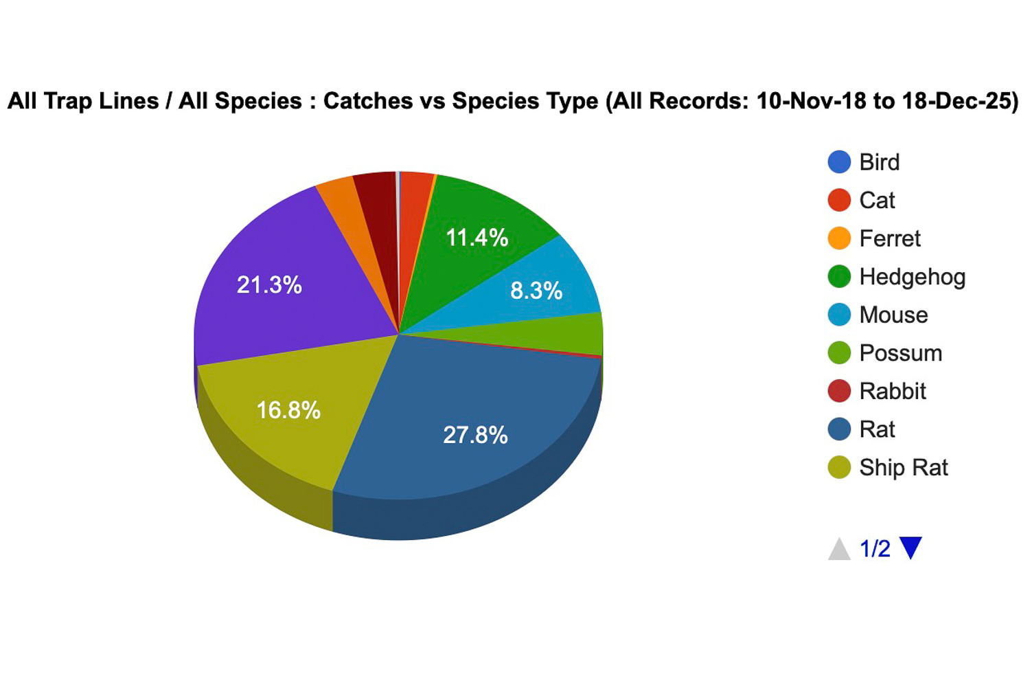
To date the CTA has currently established 28 trap lines which are maintained by an active network of volunteers. There are over 800 traps, mostly DOC 200’s and a smaller number of AT220’s, Sentinel and Trapinators targeting possum. The CTA has also introduced a live capture feral cat programme using Celium technology. It also coordinates workshops for members and interested locals on trapping techniques and the monitoring biodiversity. Data is added to TrapNZ.
The CTA trapping area covers a total of 62,000 hectares of public and privately owned land, from the Cass River in the north, to Lake Lyndon in the south. The majority of trap lines are in the Craigieburn Forest Park but also include Korowai/Torlesse Tussocklands, Castle Hill Village and other residents/ holiday homes in the area, high country station land, local ski clubs, and school outdoor education facilities. This area is of major cultural importance to Ngai Tahu.
To date the CTA has currently established 28 trap lines which are maintained by an active network of volunteers. There are over 800 traps, mostly DOC 200’s and a smaller number of AT220’s, Sentinel and Trapinators targeting possum. The CTA has also introduced a live capture feral cat programme using Celium technology. It also coordinates workshops for members and interested locals on trapping techniques and the monitoring biodiversity. Data is added to TrapNZ.